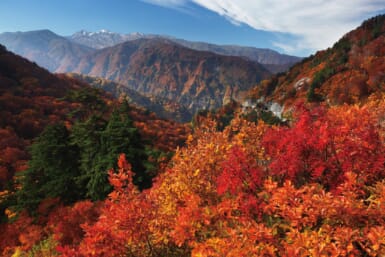
Toyama Prefecture occupies a compact, dramatic stretch of Japan’s Sea of Japan coast in the Hokuriku region of central Honshu, bordered by Ishikawa to the west, Gifu to the south, Nagano to the east and Niigata to the northeast. In just 4,248 square kilometers, the prefecture packs in 3,000-meter peaks of the Northern Japan Alps and Toyama Bay — a deep bay that plunges over 1,000 meters — creating one of the most vertically dramatic landscapes in the country. Home to around one million people, the prefecture was formerly part of Etchu Province and today is the second-smallest prefecture in the Hokuriku region.
The headline attraction is the Tateyama Kurobe Alpine Route, a 37-kilometer mountain traverse opened in 1971 that carries visitors across the Northern Alps using a relay of cable cars, highland buses, a ropeway and electric buses. Between Tateyama Station in Toyama and Ogizawa in Nagano, the route climbs to Murodo at 2,450 meters — home to Japan’s highest-altitude hotel and the famous Yuki-no-Otani “Snow Walls,” which tower up to 20 meters high each spring. Along the way lies Kurobe Dam, at 186 meters Japan’s tallest dam, and Shomyo Falls, Japan’s tallest waterfall at about 350 meters.
The Gokayama region in the southwest, home to the thatched gassho-zukuri farmhouses of Ainokura and Suganuma villages, is a UNESCO World Heritage Site shared with neighboring Shirakawa-go.