In Okinawa, one US airman was killed by high waves brought on by the typhoon, and two others are missing. The storm is still packing strong winds and heavy rain and should reach Tokyo by midday.
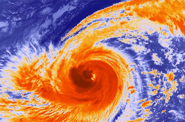
According to broadcaster NHK, Phanfone, which is moving northeast at a speed of 40 kilometers per hour, passed by the area of Wakayama Prefecture at 5 am this morning, and is buffeting Shizuoka with heavy gusts of wind and rain. Mudslide warnings have been declared in Tokushima, Wakayama, Mie and Yamanashi Prefectures, along with the islands of Miyake and Izu-Oshima, and high waves are predicted to hit areas along the Pacific coast. Currently, 80 mph winds—and gusts reaching 115 mph—are predicted for the Tokyo area, which would be the highest ever measured.
Heavy rain—80 to 100 millimeters—is expected to drench a broad swath of Honshu Island, from the west to the northeast. Some train services have been delayed or canceled, so commuters around Tokyo should check train status via Japan Rail or at private rail lines’ sites. Many schools and universities in the Tokyo area have already closed for the day, and a company spokesman for Toyota has stated that 12 plants will stop production for the day.
Phanfone was downgraded earlier from super typhoon status, and was off shore of Shikoku island Sunday evening, when it hit the region with winds of up to 144 kilometers per hour (90 miles per hour). The storm blasted through parts of Kyushu and Okinawa, where the Air Force members were washed out to sea. Several people in Kyushu were injured, and some 18,000 households in the region were without power as of late Sunday afternoon.
You can keep track of Phanfone’s progress at the Japan Meteorological Agency.
Image: NBC News
–Alec Jordan
Phanfone, Typhoon, Kanto region