Most visitors to Japan treat its mountains like backdrops and not destinations. But over 70% of the country is mountainous terrain, and much of it is accessible straight from Tokyo — without a car. This guide will spotlight five two-day hikes, each challenging enough to satisfy the seasoned trekker, but accessible by train or bus.
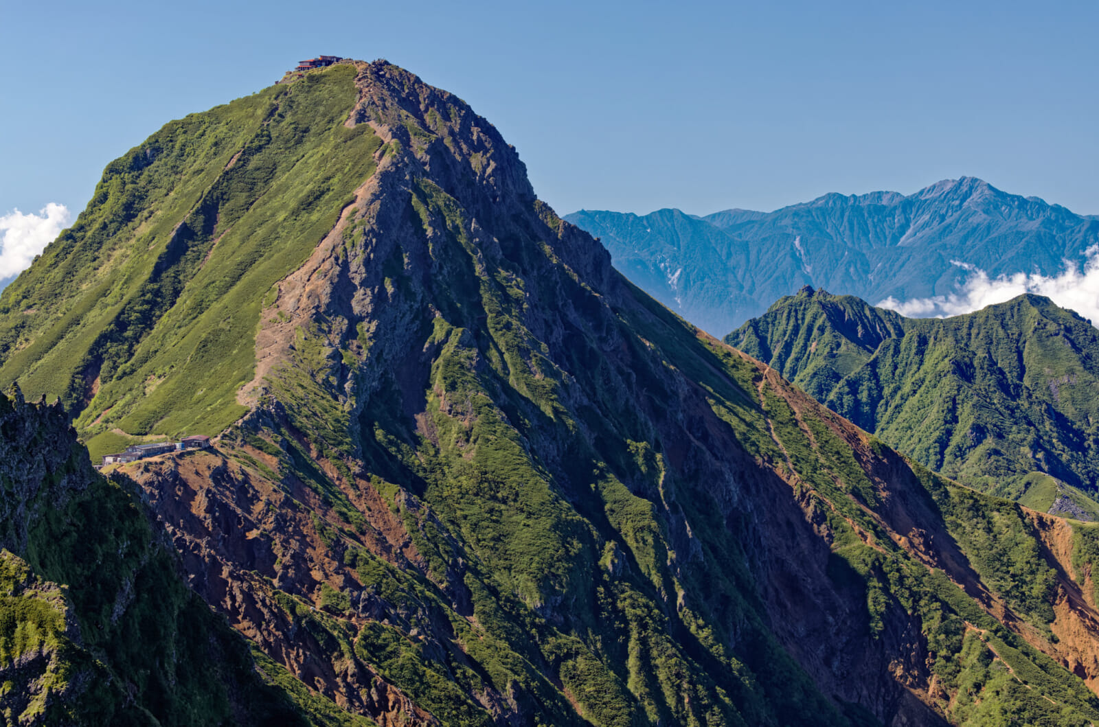
Japan’s second-highest peak at 3,193 meters, Mount Kitadake flies surprisingly under the radar compared to its famous fellow giant, Mount Fuji. But for many hikers, it offers something better: panoramic views of Fuji itself, plus a rugged, varied trail through the heart of the Southern Alps. The summit can be reached in two to four days, depending on your pace and whether you want to include nearby peaks like Mount Ainodake (Japan’s third tallest) and Mount Notoridake (one of Yamanashi’s 100 famous mountains). Together with Mount Kitadake, these mountains are known as the Shirane Sanzan, or Three White Peaks.
For a weekend itinerary, aim for the two-day route, with a night at Kitadake Katanokoya Hut, perched just below the summit. The hut is well loved for its pork steaks.
Difficulty: Moderate to difficult. While this route isn’t technically demanding, it is considerably long and rugged, with the kind of grade that will test your quads and calves to their absolute limits. Physical stamina and aerobic fitness are musts. For anyone not used to exerting themselves at high elevations, there’s also the concern of altitude sickness.
Access: The trailhead begins at Hirogawara in Minami Alps National Park, a protected zone closed to private vehicles. The easiest route is via Kofu, which is about 90 minutes from Tokyo’s Shinjuku Station by limited express train. From Kofu Station, take a Yamanashi Kotsu bus to Hirogawara (roughly two hours, ¥2,400 one way). Check the seasonal bus schedule in advance, as service is limited and operates mainly in summer.
Mount Tsukuba
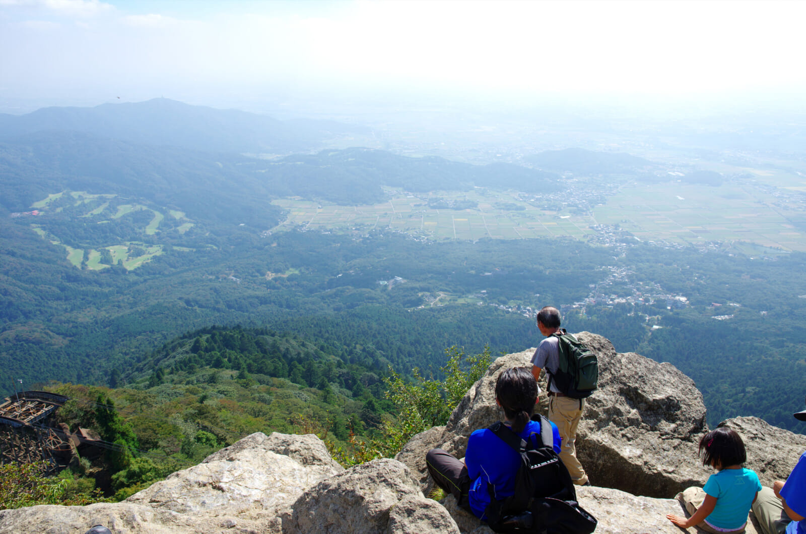
At just 877 meters, Mount Tsukuba is the lowest of Japan’s 100 famous mountains, yet its twin peaks — Mount Nyotai and Mount Nantai — rise abruptly over the Kanto Plain and command sweeping views that stretch to Tokyo Skytree and Mount Fuji on a clear day. The mountain is tailor-made for first-time hikers and families: Multiple well-marked trails provide options for every fitness level, a ropeway and cable car shorten or skip the ascent entirely, and the base area around Tsukubasan Jinja Shrine overflows with cafes, souvenir stalls and post-hike hot spring baths.
Though you can finish the round trip in half a day, linger for seasonal highlights — plum blossoms in late February, azaleas in May, colorful maples in November — or tack on a soak at Tsukubasan Onsen before heading back to the city.
Difficulty: Easy to moderate. The gentlest paths (Mukaeba and the Mountaintop Connection Trail) are partially stone-paved and very family-friendly; steeper options like Shirokumonashi give your calves a workout but stay non-technical.
Access: From Asakusa Station, take the Tsukuba Express to Tsukuba Station (about 45 minutes), then walk to the neighboring Tsukuba Center bus terminal and transfer to the Tsukubasan Shuttle bound for Tsutsujigaoka. Alight at Tsukubasan Jinja Iriguchi (approximately 40 minutes). The bus accepts IC cards and runs one to two times per hour (depending on the season) between 8 a.m. and 3 p.m. (3:30 p.m. on weekends and national holidays). Return shuttles run slightly later, with a final bus departing Tsukubasan Jinja Iriguchi at 5:10 p.m. Be sure to check the shuttle schedule before heading out for updated times. A direct highway bus runs daily from Tokyo Station (Yaesu South Exit) to Tsukuba Center, where you’ll need to transfer to the same shuttle for the final leg. Note that there is no shuttle service available between December 1 and the last day of February.
Mount Yakedake
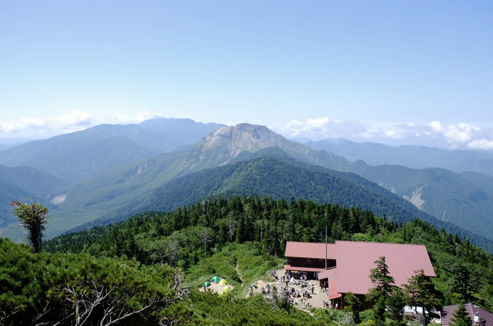
Straddling the border of Nagano and Gifu prefectures, Mount Yakedake is the sole active volcano in the Northern Alps. At 2,455 meters high, its south peak — off-limits to climbers due to potential rock falls — belches sulfurous steam into the air. The north peak sits slightly lower at 2,444 meters, but offers commanding views of the surrounding ridgelines and the Kamikochi valley below.
Most hikers tackle Yakedake as a day hike from Kamikochi, a stunning alpine basin surrounded by towering peaks. The trail is steep but short, gaining serious altitude in just a few hours. For those looking to stretch it into an overnight hike, there are two huts in the area, one on the north side of Yakedake and the other at the base of Mt. Nishihotakadake, a three-plus-hour hike away on the north side. Ambitious (and highly experienced) trekkers can continue on a difficult, technical ridge route toward Mount Nishihotakadake — a remote climb that requires scrambling, exposure and a helmet.
Difficulty: Moderate. While not technically difficult, the trail is relentlessly steep and involves sustained climbing over a short distance. The volcano’s active status adds an extra layer of awe and adrenaline, though it also means that helmets are recommended and remaining alert to danger is essential. Before hiking any volcano, be sure to check its status via the Japan Meteorological Agency.
Access: Mount Yakedake can be approached from Kamikochi or Shinhotaka Onsen. Kamikochi is accessible via bus from Matsumoto, with private cars restricted past the gateway town of Sawando. Shinhotaka, on the opposite side, can be reached from Takayama by bus. A popular one-way route involves crossing the mountain from Kamikochi to Shinhotaka (or vice versa), then soaking in the hot springs on the other side.
Mount Tsubakuro
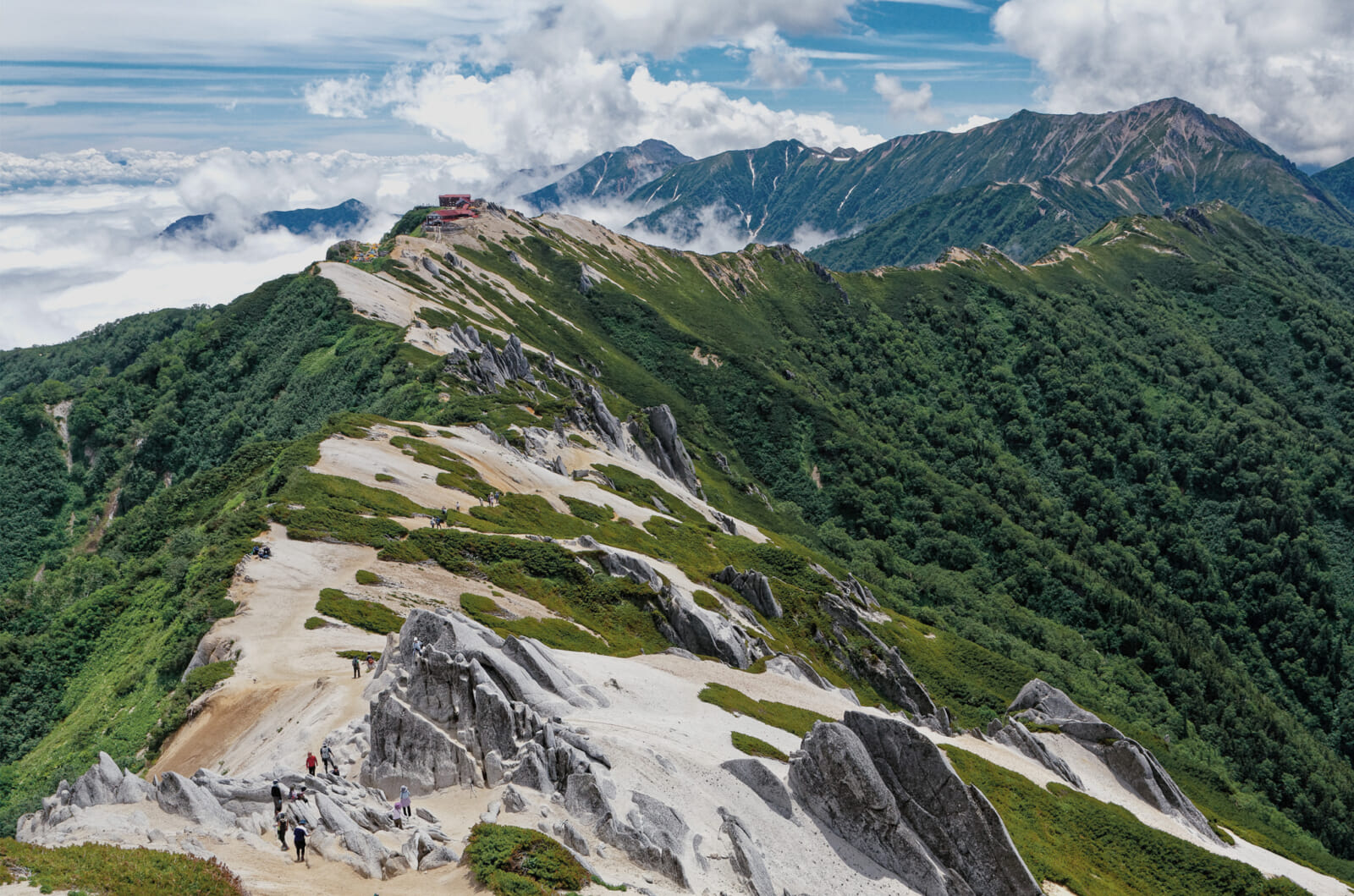
Nicknamed the “Queen of the Northern Alps,” Mount Tsubakuro stands 2,763 meters tall and is one of the most picturesque peaks in central Honshu. Its pale granite ridgeline, sweeping views and relatively accessible trail make it a favorite for first-time Northern Alps hikers. Despite its beauty, the trail poses a real physical challenge — especially the steep ascent up Kassen-one Ridge, one of the “three steep climbs” of the Japanese Alps.
The route has no dangerous sections, making it ideal for confident beginners looking to move beyond basic day hikes. Just below the summit is the historic Enzanso Hut, one of Japan’s oldest mountain lodges, known for its cozy atmosphere and panoramic views. About an hour further down, slower hikers can rest at Kassengoya, known for its chilled watermelon and hearty udon.
Difficulty: Easy to moderate. The trail is steep and physically demanding but not technical. Snow may linger in early summer, and the granite can get slippery in wet weather.
Access: From Shinjuku Station, take the JR Chuo Line Limited Express to Matsumoto Station (about two hours, 40 minutes). Transfer to the JR Oito Line and ride to Hotaka Station (30 minutes). From there, take a seasonal bus (about 60 minutes) or taxi to Nakabusa Onsen, the trailhead.
Mount Tanigawadake
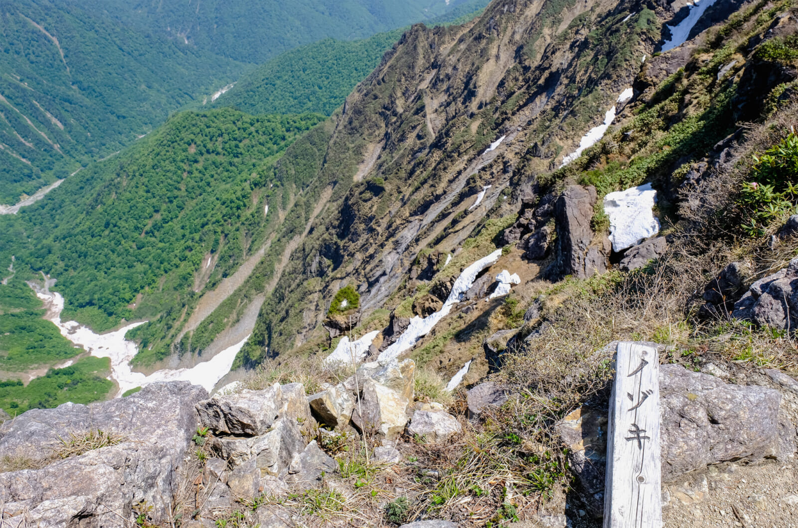
Rising to 1,977 meters, Mount Tanigawadake offers something for everyone — from easy ropeway-assisted hikes to advanced ascents recognized as some of Japan’s steepest and most challenging. It’s one of the country’s most varied and storied peaks, appealing to both casual trekkers and seasoned alpinists.
Tanigawadake is also one of the “three great rock faces” of Japan, along with Mount Tsurugidake in Toyama and Mount Hotaka in the Northern Alps. Its notorious reputation stems from its history: Tanigawadake is a serious contender for the highest number of climbing-related fatalities in the world, earning it the nickname “mountain of death.” But don’t worry — the real danger is mostly limited to Ichinokurasawa, a sheer rock face favored by technical climbers. The most common route, the Tenjin-one Ridge trail, is an entirely different experience — a safe, beginner-friendly hike that becomes even more accessible with the help of the Tanigawa Ropeway. For most visitors, Tanigawadake is not only approachable but stunningly scenic, especially in autumn when the foliage sets the ridgeline ablaze with color.
Difficulty: Various. Tanigawadake lets you choose your adventure — an easy(ish) hike from the ropeway station or more difficult climbs for experienced mountaineers. The standard out-and-back via Tenjin-one Ridge is suitable for beginners in fair weather. Speaking of the elements — Tanigawadake forms part of the ridge dividing Japan’s Pacific side from its Sea of Japan side, and as a result, is subject to dizzyingly fast weather changes. Be sure to come prepared for anything, and to turn around at the first sign of foreboding weather.
Access: From Tokyo Station, take the Joetsu Shinkansen (Toki or Tanigawa) and arrive at Jomo-Kogen Station. Catch the bus from the station to the Tanigawadake Ropeway base station (approximately 45 minutes). From Tokyo Station to trailhead, the whole trip takes about two hours.
Before You Go: Safety First
Japan’s mountains may be accessible, but they’re still mountains — and conditions can change fast. Always pack layers for sudden weather shifts, carry a basic first-aid kit and wear proper hiking footwear (yes, people really do try to hike in flip-flops). Bring a paper map or offline GPS; Yamap is a great option that lets you plan your route, track your location in real time and check trail notes and photos from other hikers. Before you go, be sure to check the forecast and trail conditions. For multiday hikes, it’s strongly recommended — and often required — to submit a hiking plan (tozan todoke) to the local police, mountain hut or trailhead safety post. And don’t forget the emergency numbers: 110 for police, 119 for fire and ambulance. Stay safe, stay smart and enjoy the trail!